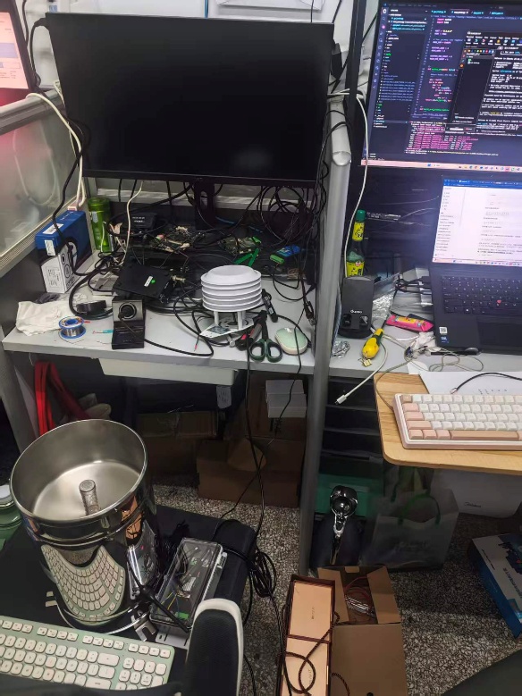
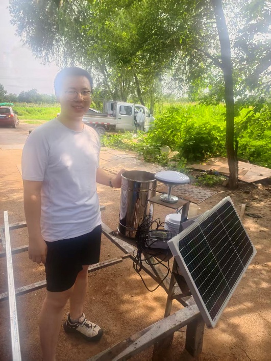
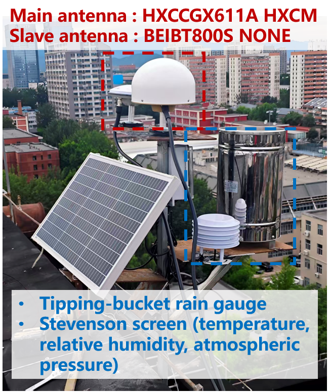
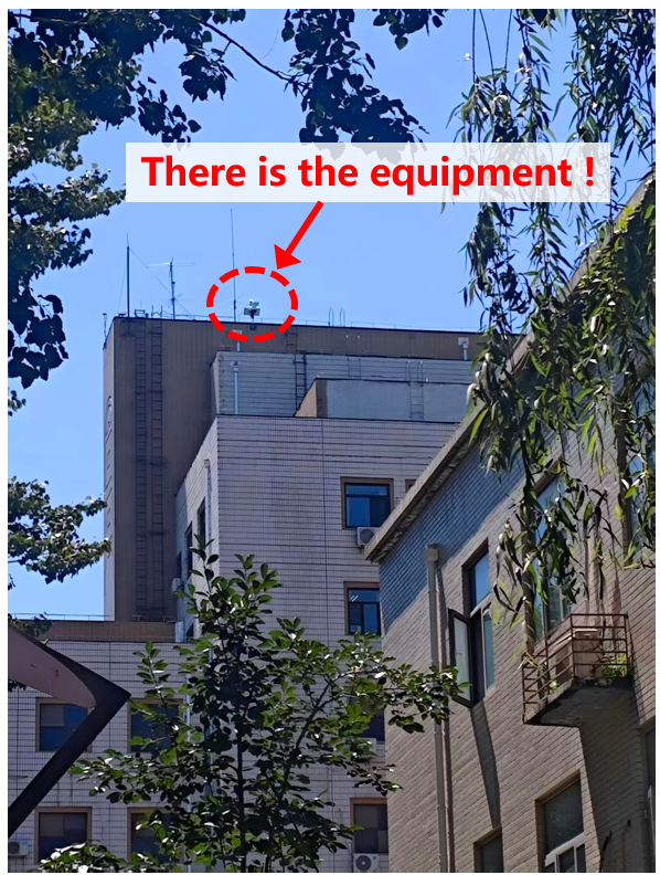
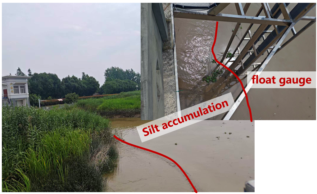
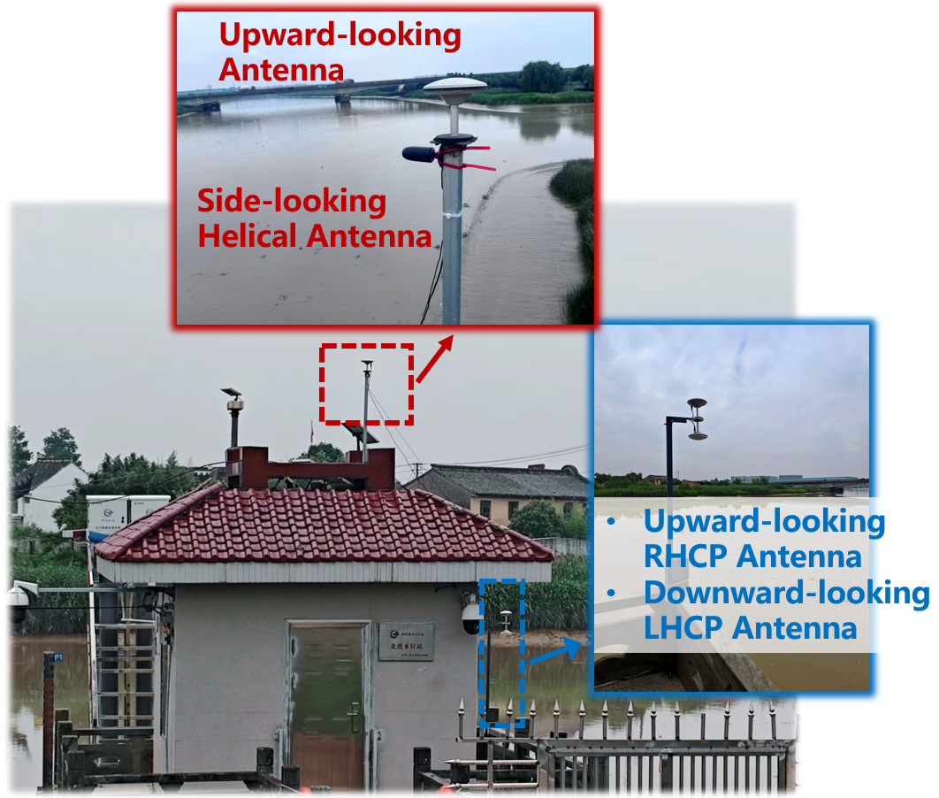
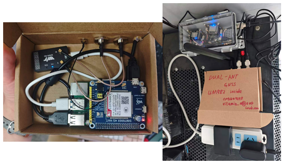
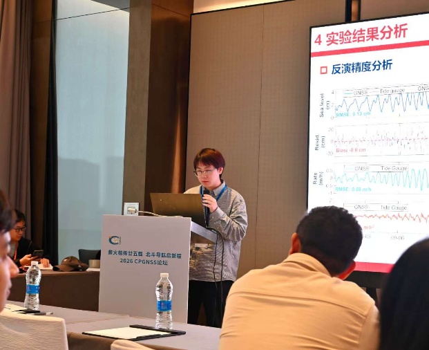
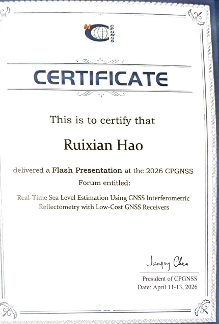
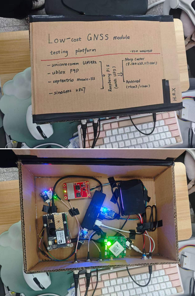
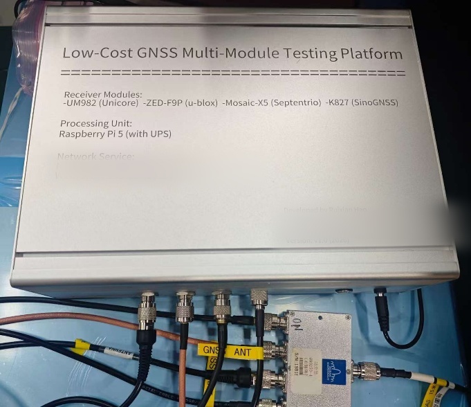
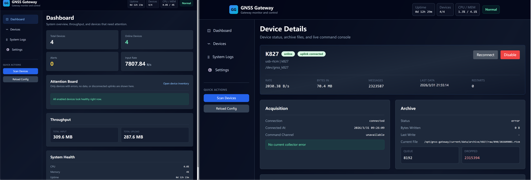
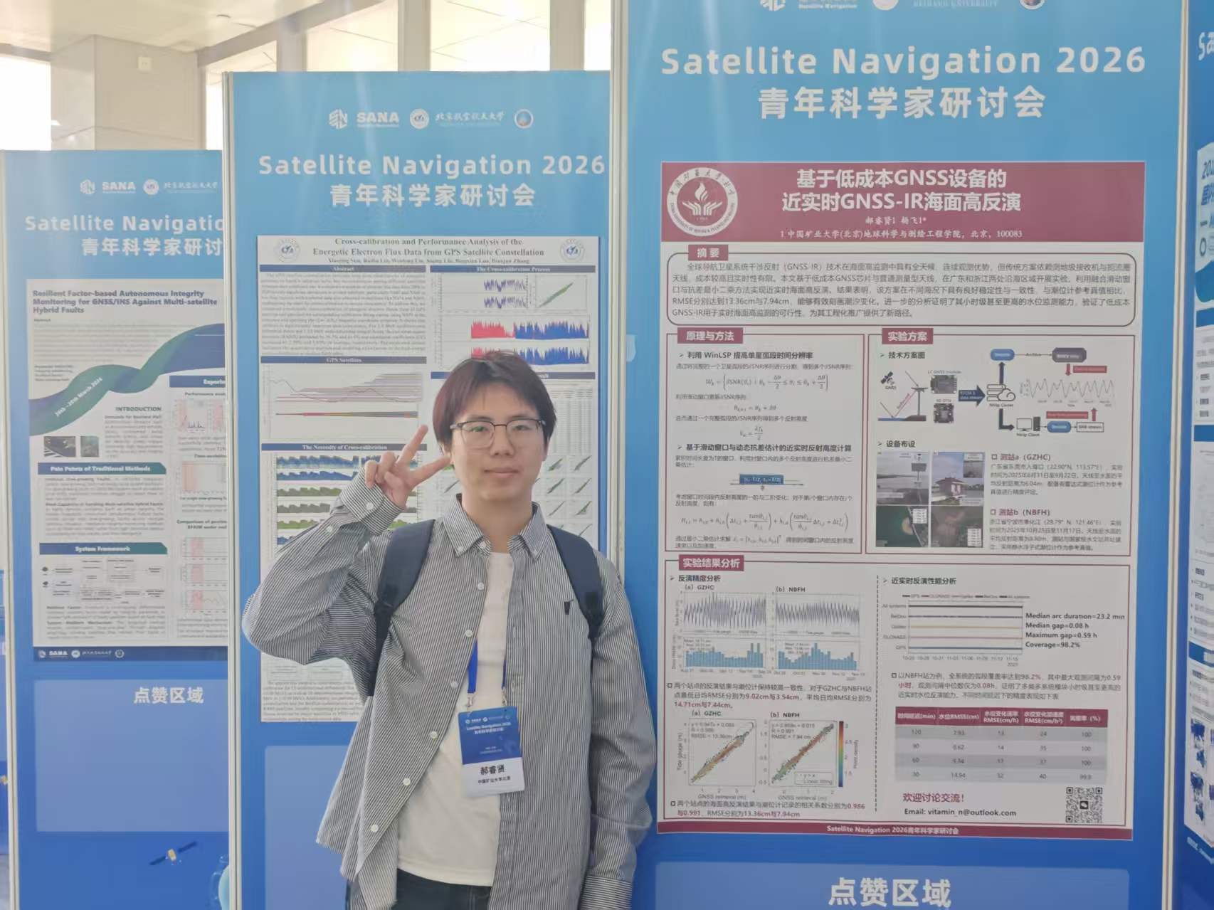
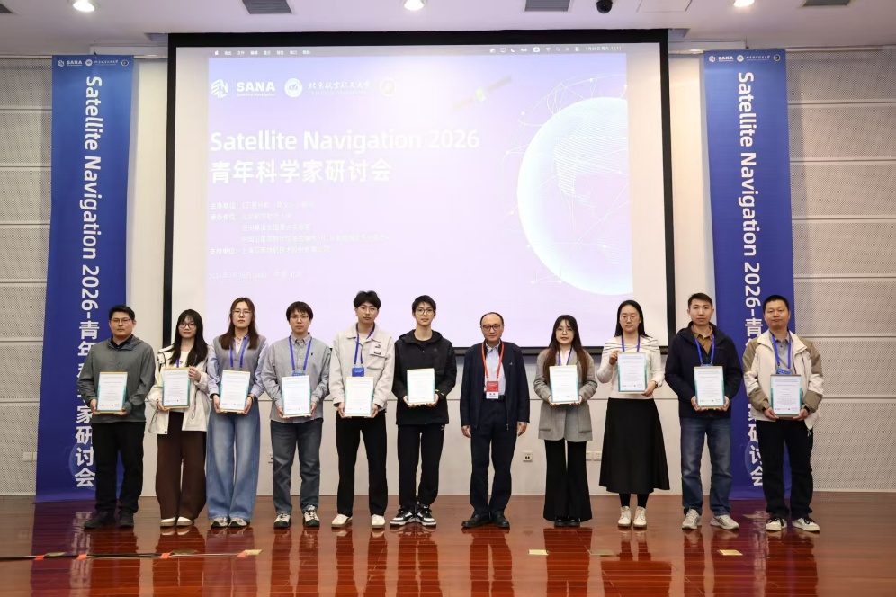
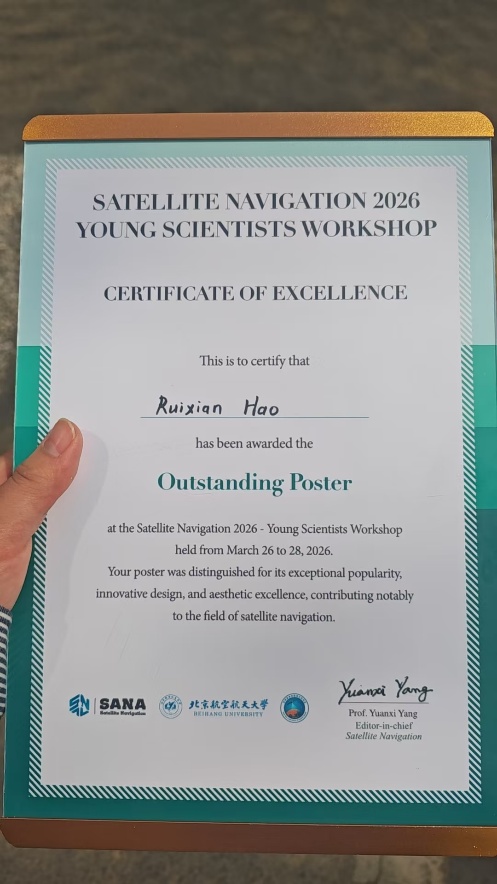
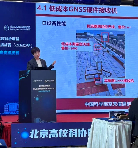
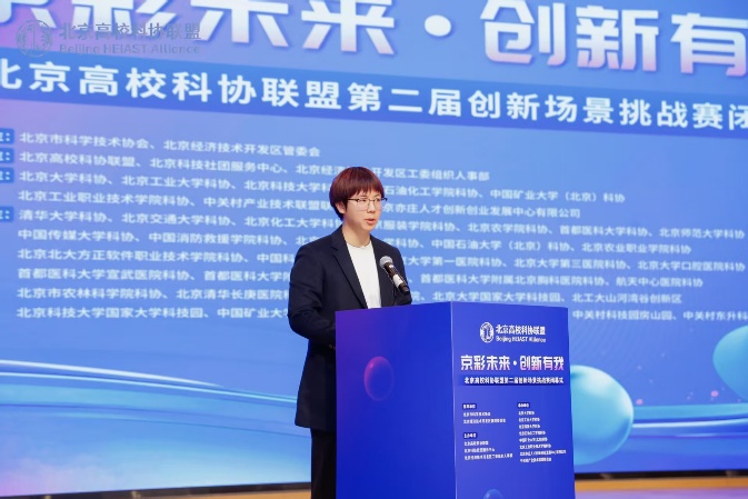
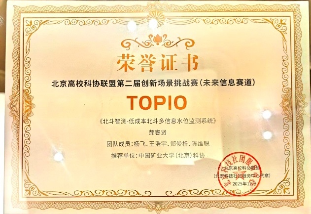
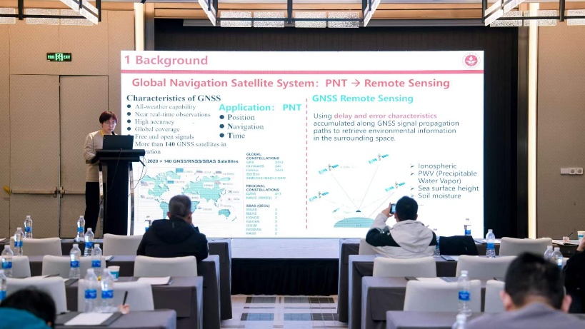
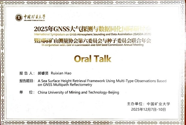
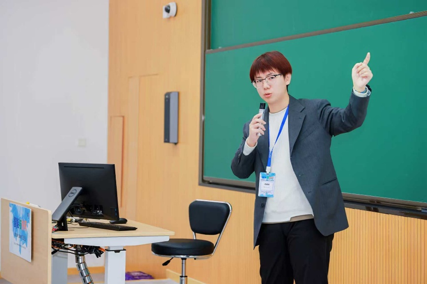
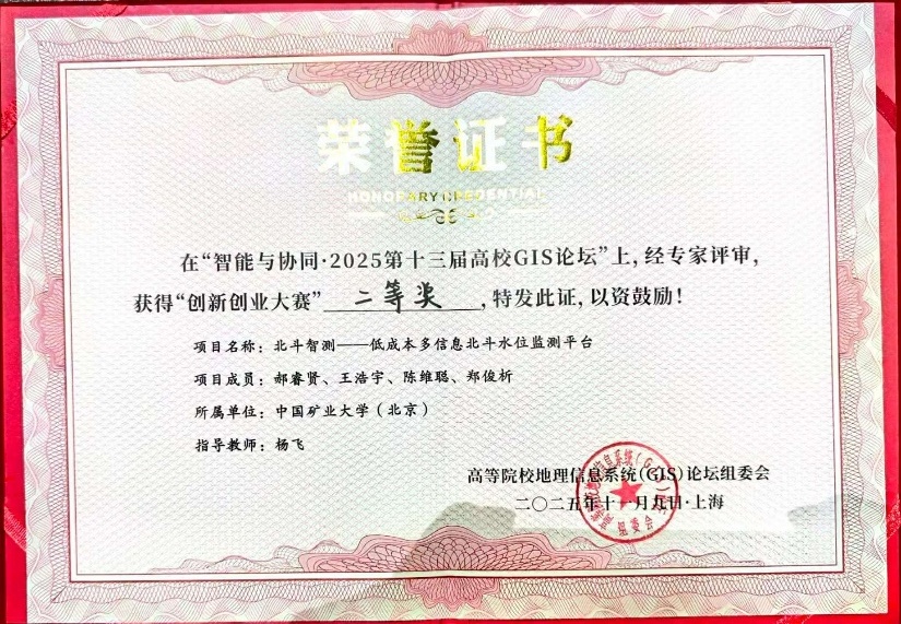
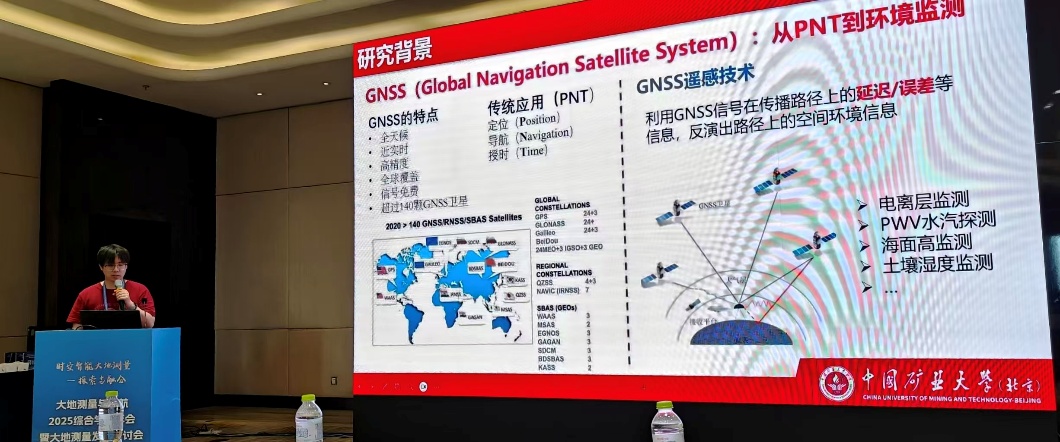
<?xml version="1.0" encoding="utf-8"?><feed xmlns="http://www.w3.org/2005/Atom" xml:lang="en"><generator uri="https://jekyllrb.com/" version="4.4.1">Jekyll</generator><link href="https://haoruixian.github.io/feed.xml" rel="self" type="application/atom+xml"/><link href="https://haoruixian.github.io/" rel="alternate" type="text/html" hreflang="en"/><updated>2026-08-12T06:01:39+00:00</updated><id>https://haoruixian.github.io/feed.xml</id><title type="html">blank</title><subtitle>Academic website of Ruixian Hao, featuring research on GNSS meteorology, tropospheric delay modeling, atmospheric water vapor, GNSS water vapor tomography, and GNSS reflectometry for water-level and sea-surface monitoring. </subtitle><entry><title type="html">Deploying a Multi-Sensor GNSS Observation Station</title><link href="https://haoruixian.github.io/blog/2026/rooftop-gnss-observation-station/" rel="alternate" type="text/html" title="Deploying a Multi-Sensor GNSS Observation Station"/><published>2026-07-14T00:00:00+00:00</published><updated>2026-07-14T00:00:00+00:00</updated><id>https://haoruixian.github.io/blog/2026/rooftop-gnss-observation-station</id><content type="html" xml:base="https://haoruixian.github.io/blog/2026/rooftop-gnss-observation-station/"><![CDATA[<div data-lang-en=""> <p>After several weeks of planning, equipment selection, and field work, I successfully deployed a comprehensive GNSS observation station on the rooftop of our university building. The project covered the complete workflow from system design and procurement to support-bracket fabrication, installation, commissioning, and remote data access. The platform combines high-precision GNSS observations with meteorological and precipitation measurements, creating a complete experimental infrastructure for GNSS meteorology, multi-sensor integration, atmospheric remote sensing, and GNSS data-quality analysis.</p> <p>The GNSS subsystem uses a dual-antenna configuration. The primary antenna is a Huaxin choke-ring antenna, selected for stable and high-quality geodetic observations and improved multipath control. The secondary antenna is a Beitian surveying antenna that can support dual-antenna positioning, attitude determination, and comparative studies of different antenna types. This arrangement also makes it possible to test different processing strategies with two antennas operating under the same local environment.</p> </div> <div data-lang-zh=""> <p>经过一段时间的方案设计、设备选型和现场安装，我完成了实验室综合楼楼顶 GNSS 综合观测基站的部署。整个项目覆盖了系统方案设计、设备采购、支架设计制作、现场安装调试以及后续远程数据访问等完整流程。这套系统不仅能够开展高精度 GNSS 观测，还集成了气象传感器和降雨监测设备，为后续 GNSS 气象学、多传感器融合、大气遥感以及 GNSS 数据质量分析提供了完整的实验平台。</p> <p>整个观测系统采用双天线配置，包括一套主天线和一套从天线。主天线选用了华信扼流圈天线，用于获得更加稳定、高质量的大地测量观测数据，并改善多路径效应的影响；从天线采用北天普通测量型 GNSS 天线，可用于双天线定位、姿态解算以及不同类型天线性能的对比研究。双天线在相同周边环境下同步工作，也便于后续验证不同的数据处理策略。</p> </div> <figure class="blog-figure"> <img src="/assets/img/blog/01-desk-debugging.jpeg" alt="The equipment being debugged at my workstation" loading="lazy"/> <figcaption><span data-lang-en="">Debugging the equipment at my workstation.</span><span data-lang-zh="">在工位调试设备。</span></figcaption> </figure> <figure class="blog-figure"> <img src="/assets/img/blog/02-field-assembly.jpeg" alt="Fabricating the support bracket in the field" loading="lazy"/> <figcaption><span data-lang-en="">Fabricating the support bracket in the field.</span><span data-lang-zh="">外出进行支架的焊接制作。</span></figcaption> </figure> <div data-lang-en=""> <h2 id="environmental-monitoring">Environmental monitoring</h2> <p>Alongside the GNSS equipment, I installed a compact automatic weather station. It includes a Stevenson screen containing temperature, relative-humidity, and atmospheric-pressure sensors, as well as a tipping-bucket rain gauge for continuous precipitation monitoring. These observations provide independent environmental information for GNSS meteorology, tropospheric-delay modeling, precipitation monitoring, and later validation of GNSS-derived parameters.</p> <p>The sensors and rain gauge are connected to a 4G communication module, which uploads observations to an Alibaba Cloud server over the public cellular network. The server stores and organizes the observations for later analysis, providing a fully automated workflow for remote data collection, storage, and management without requiring a permanent on-site computer.</p> </div> <div data-lang-zh=""> <h2 id="section">气象与降雨监测</h2> <p>除了 GNSS 设备外，我还在基站附近安装了一套小型自动气象观测系统。系统配备了气象百叶盒，内部集成温度、相对湿度和大气压力传感器，同时配置了一台翻斗式雨量计，用于连续记录降雨信息。这些环境观测数据可以支持 GNSS 气象学、对流层延迟建模、降水监测等研究，也可以作为 GNSS 反演大气参数时的独立验证资料。</p> <p>气象传感器和雨量计均接入 4G 数据传输模块，通过公网将观测数据实时上传至阿里云服务器，并在服务器端完成数据存储、管理与后续分析。这样就形成了一套不依赖现场电脑、可以远程运行的自动化采集流程，减少了后续维护和人工抄录数据的工作量。</p> </div> <figure class="blog-figure"> <img src="/assets/img/blog/03-final-rooftop-station.png" alt="The completed rooftop observation station" loading="lazy"/> <figcaption><span data-lang-en="">The completed rooftop observation station.</span><span data-lang-zh="">最终安装完成的楼顶设备。</span></figcaption> </figure> <figure class="blog-figure"> <img src="/assets/img/blog/04-building-view.png" alt="A view of the installed equipment from the ground" loading="lazy"/> <figcaption><span data-lang-en="">The station viewed from the ground.</span><span data-lang-zh="">从楼下看到的设备，非常骄傲！</span></figcaption> </figure> <div data-lang-en=""> <h2 id="shared-gnss-signal-acquisition">Shared GNSS signal acquisition</h2> <p>The GNSS signals follow a separate acquisition architecture. A 90 m low-loss RF cable carries each antenna signal into the laboratory, where a GNSS RF splitter distributes the same signal to receivers from several manufacturers, including Septentrio, BDStar, SinoGNSS, and Huace. This shared-signal configuration allows different receivers to observe the same signal at the same time, providing a consistent platform for receiver-performance evaluation, observation-quality assessment, and GNSS algorithm comparisons under identical signal conditions.</p> <h2 id="off-grid-power-and-edge-computing">Off-grid power and edge computing</h2> <p>Because stable commercial power is unavailable on the rooftop, the environmental monitoring system is powered by a 30 W solar panel and a 20 Ah rechargeable battery. This independent power supply supports the weather station, rain gauge, and 4G communication module for long-term operation, while reducing the need for maintenance visits to the rooftop.</p> <p>The complete platform is managed by an RK3588-based embedded computer running Linux. It acts as the edge-computing controller for device management, local data acquisition, and communication with the remote server. I was involved in every stage of the project, from system design and equipment procurement to custom bracket fabrication, installation, and commissioning. Through this process, I learned how to read temperature, humidity, and pressure observations, poll remote devices over a public network, and connect multiple sensors into one reliable data-acquisition workflow. The experience also strengthened my understanding of Linux deployment, embedded-device management, and the design of real-time GNSS monitoring and edge-computing systems.</p> </div> <div data-lang-zh=""> <h2 id="section-1">多接收机共享信号采集</h2> <p>GNSS 部分采用了独立的数据采集架构。天线信号通过 90 m 低损耗射频馈线引入办公室，并接入小型机柜中的 GNSS 射频功分器，将同一路天线信号分配给多个不同厂商的 GNSS 接收机同步采集。目前已接入 Septentrio、北斗星通、司南导航、华测导航等品牌的设备。由于不同接收机可以同时观测完全相同的信号，这套共享信号架构能够为接收机性能评估、观测数据质量分析以及 GNSS 算法对比研究提供统一、公平的数据采集平台。</p> <h2 id="section-2">太阳能供电与边缘计算</h2> <p>由于楼顶现场无法提供稳定市电，环境监测系统采用独立的太阳能供电方案，包括 30 W 太阳能电池板和 20 Ah 蓄电池，为雨量计、气象传感器以及 4G 通信模块持续供电，保证系统能够长期稳定运行，同时减少频繁登上楼顶维护设备的需要。</p> <p>整套系统最终采用 RK3588 嵌入式平台运行 Linux 系统，负责设备管理、本地数据采集和与远程服务器的通信。从方案设计、设备采购、支架设计制作到现场安装调试，我都参与并负责了整个过程。在这一过程中，我学习了如何读取温度、湿度和气压等气象数据，如何通过公网轮询方式获取远程设备数据，以及如何将多个传感器连接成稳定可靠的数据采集流程。通过本次项目，我进一步熟悉了 GNSS 硬件系统搭建、Linux 系统部署、嵌入式设备管理、远程数据采集以及多传感器数据融合，也为今后开发实时 GNSS 监测系统和边缘计算平台积累了实践经验。</p> </div>]]></content><author><name></name></author><category term="research-projects"/><category term="GNSS meteorology"/><category term="research infrastructure"/><category term="multi-sensor systems"/><category term="field deployment"/><summary type="html"><![CDATA[A field report on designing, installing, and commissioning a rooftop GNSS and environmental monitoring platform.]]></summary></entry><entry><title type="html">Deploying a New GNSS-IR Experimental Platform at the Ningbo Hydrological Station</title><link href="https://haoruixian.github.io/blog/2026/ningbo-gnss-ir-field-experiment/" rel="alternate" type="text/html" title="Deploying a New GNSS-IR Experimental Platform at the Ningbo Hydrological Station"/><published>2026-06-17T00:00:00+00:00</published><updated>2026-06-17T00:00:00+00:00</updated><id>https://haoruixian.github.io/blog/2026/ningbo-gnss-ir-field-experiment</id><content type="html" xml:base="https://haoruixian.github.io/blog/2026/ningbo-gnss-ir-field-experiment/"><![CDATA[<div data-lang-en=""> <p>I recently traveled to Ningbo to conduct a new round of GNSS-IR field experiments at the Ningbo Hydrological Station. Building upon the encouraging results obtained during last year’s campaign, this visit focused on deploying an upgraded observation platform and evaluating several new GNSS-IR configurations under real operational conditions.</p> <h2 id="a-practical-motivation-for-gnss-ir-water-level-monitoring">A practical motivation for GNSS-IR water-level monitoring</h2> <p>The motivation for this work comes from a practical problem at the hydrological station. Over time, significant sediment has accumulated inside the stilling well, preventing the traditional float-type water-level gauge from operating properly during low tide. As the water level drops, the float becomes obstructed by the accumulated silt and can no longer follow the water surface. The lowest water levels are therefore missing from the conventional record, which creates a clear limitation for continuous hydrological monitoring.</p> <p>GNSS Interferometric Reflectometry (GNSS-IR) offers a useful non-contact complement to the mechanical gauge. It estimates water level from the interference between direct and surface-reflected satellite signals, so its measurements are not affected by sediment inside the stilling well. This makes GNSS-IR particularly valuable during extremely low-tide conditions, when the conventional float gauge is most likely to fail.</p> </div> <div data-lang-zh=""> <p>最近我前往宁波水文站开展了一次新的 GNSS-IR 现场实验。本次工作基于去年实验取得的成果，重点部署升级后的观测平台，并在真实运行环境下验证更加丰富的 GNSS-IR 观测方案。</p> <h2 id="gnss-ir-">GNSS-IR 水位监测的实际需求</h2> <p>本次实验的背景来源于宁波水文站遇到的一个实际工程问题。由于长期泥沙淤积，水位井底部出现了较为严重的沉积，导致传统浮子式水位计在低潮位时无法正常工作。当水位下降到一定高度后，浮子会受到淤泥阻碍，无法继续跟随水面下降，因此最低潮位无法被准确记录，给连续水文监测带来了一定影响。</p> <p>GNSS-IR 是一种非接触式遥感观测技术，可以利用卫星直射信号与水面反射信号之间的干涉信息反演水位。由于它不依赖水位井内部的机械浮子，因此不会受到淤泥沉积的影响，尤其适合在传统水位计容易失效的极端低潮位条件下，为传统水位观测提供可靠补充。</p> </div> <figure class="blog-figure"> <img src="/assets/img/blog/0617-stilling-well-sediment.png" alt="Sediment accumulation inside the stilling well, which obstructs the conventional float gauge" loading="lazy"/> <figcaption><span data-lang-en="">Sediment accumulation inside the stilling well and the affected float gauge.</span><span data-lang-zh="">水位井内的淤泥沉积，以及受到影响的浮子式水位计。</span></figcaption> </figure> <div data-lang-en=""> <h2 id="new-observation-configurations">New observation configurations</h2> <p>Our previous campaign at this site demonstrated promising GNSS-IR sea-level retrieval results. During this visit, we expanded the original platform to test more diverse observation strategies.</p> <p>The first upgrade was the installation of a side-looking small helical antenna oriented toward the water surface. Unlike a conventional surveying antenna, this low-cost directional antenna is designed to strengthen the reception of reflected signals from the water while reducing unwanted signals from other directions. We will evaluate whether this stronger directional response can improve the accuracy and stability of GNSS-IR water-level retrievals.</p> <p>We also carried out our first dual-antenna GNSS-IR experiment at the site. The system combines a custom left-hand circularly polarized (LHCP) antenna with a conventional right-hand circularly polarized (RHCP) GNSS antenna. Both antennas are connected to an Allystar UM982 high-precision GNSS receiver for synchronized observations. Because signals reflected from a water surface often undergo polarization reversal, the LHCP antenna is expected to receive the reflected component more effectively. The dual-polarization configuration may therefore provide richer reflection information and new data for GNSS-IR algorithm development.</p> </div> <div data-lang-zh=""> <h2 id="section">新的观测方案</h2> <p>去年，我们已经在该站点完成了 GNSS-IR 海（水）面高反演实验，并取得了较好的实验效果。本次再次来到宁波，主要是在原有实验平台基础上开展更加多样化的观测方案验证。</p> <p>首先，我们新增了一副面向水面的侧视小型螺旋天线。与传统测量型天线相比，这种低成本定向天线专门面向水面方向设计，能够增强水面反射信号的接收，同时减少其他方向信号的干扰。后续实验将重点验证，更强的方向性是否能够进一步提升 GNSS-IR 海（水）面高反演的精度和稳定性。</p> <p>与此同时，本次实验首次尝试了双天线 GNSS-IR 观测模式。我们定制了一副左旋圆极化（LHCP）天线，与常规右旋圆极化（RHCP）GNSS 天线组成双天线观测系统，并连接至和芯星通 UM982 高精度 GNSS 接收机开展同步观测。由于水面反射信号通常会发生极化翻转，LHCP 天线理论上能够更加有效地接收反射信号。因此，双极化观测有望提供更加丰富的反射信息，为 GNSS-IR 算法研究提供新的数据来源。</p> </div> <figure class="blog-figure"> <img src="/assets/img/blog/0617-final-gnss-ir-deployment.png" alt="The final GNSS-IR deployment with the upward-looking RHCP antenna and downward-looking LHCP antenna" loading="lazy"/> <figcaption><span data-lang-en="">The final deployment at the hydrological station.</span><span data-lang-zh="">最终部署完成的 GNSS-IR 观测平台。</span></figcaption> </figure> <div data-lang-en=""> <h2 id="real-time-data-acquisition-and-edge-computing">Real-time data acquisition and edge computing</h2> <p>The field data-acquisition platform uses a Raspberry Pi as its edge-computing controller. It manages the GNSS receiver and collects the raw observations locally. A SIM7600CE 4G module provides real-time wireless transmission, allowing the station to operate without a permanent wired network connection.</p> </div> <div data-lang-zh=""> <h2 id="section-1">实时数据采集与边缘计算</h2> <p>本次实验的数据采集设备以树莓派作为边缘计算平台，负责 GNSS 接收机控制和原始观测数据采集。通信部分采用 SIM7600CE 4G 模块，实现观测数据的远程实时传输，使整套设备不依赖固定的有线网络即可运行。</p> </div> <figure class="blog-figure"> <img src="/assets/img/blog/0617-gnss-data-platform.png" alt="The GNSS data-acquisition equipment, including the Raspberry Pi, UM982 receiver, and communication hardware" loading="lazy"/> <figcaption><span data-lang-en="">The field GNSS data-acquisition platform.</span><span data-lang-zh="">本次实验使用的 GNSS 数据采集设备。</span></figcaption> </figure> <div data-lang-en=""> <p>Instead of transmitting standard RINEX files, the system streams Allystar’s proprietary raw observation format to a remote server. The observations are decoded and processed in real time on the server, establishing a complete data link for future real-time GNSS-IR water-level monitoring and algorithm testing. This architecture connects field instruments, wireless communication, server-side processing, and remote research workflows into one continuous system.</p> <p>This field campaign further improved the GNSS-IR observation platform at the Ningbo Hydrological Station and produced valuable datasets for evaluating low-cost directional antennas, dual-polarization GNSS-IR methods, and real-time edge-computing systems. These experiments provide a strong foundation for continuous, real-time, and high-precision water-level monitoring based on GNSS-IR.</p> </div> <div data-lang-zh=""> <p>数据传输采用和芯星通自定义的原始观测数据格式，而不是先转换成标准 RINEX 文件。原始数据被实时发送至服务器，并在服务器端完成解析与计算，从而建立起一条完整的实时数据链路，为后续实时 GNSS-IR 海（水）面高监测算法和远程实验提供支持。这套架构将现场设备、无线通信、服务器处理和远程科研流程连接成一个连续运行的系统。</p> <p>本次实验不仅进一步完善了宁波水文站的 GNSS-IR 观测平台，也为低成本定向天线、双极化 GNSS-IR 以及实时边缘计算系统等方向提供了宝贵的实测数据，为后续开展连续、实时、高精度水位监测研究奠定了基础。</p> </div>]]></content><author><name></name></author><category term="research-projects"/><category term="GNSS-IR"/><category term="sea-level monitoring"/><category term="low-cost GNSS"/><category term="field deployment"/><summary type="html"><![CDATA[A field report on upgrading a GNSS-IR water-level monitoring platform with directional antennas, dual-polarization observations, and real-time edge computing.]]></summary></entry><entry><title type="html">Sharing Our Research at CPGNSS Forum 2026</title><link href="https://haoruixian.github.io/blog/2026/cpgnss-forum-2026/" rel="alternate" type="text/html" title="Sharing Our Research at CPGNSS Forum 2026"/><published>2026-04-13T00:00:00+00:00</published><updated>2026-04-13T00:00:00+00:00</updated><id>https://haoruixian.github.io/blog/2026/cpgnss-forum-2026</id><content type="html" xml:base="https://haoruixian.github.io/blog/2026/cpgnss-forum-2026/"><![CDATA[<div data-lang-en=""> <p>I recently attended CPGNSS Forum 2026 in Nanjing, where I delivered an oral presentation on our latest work in real-time sea-level retrieval using low-cost GNSS receivers. The meeting gave me an opportunity not only to present our research progress, but also to exchange ideas with specialists and young researchers working across the wider GNSS community.</p> </div> <div data-lang-zh=""> <p>最近我前往南京参加了 CPGNSS Forum 2026，并在会议期间作了口头报告，分享了我们团队在低成本 GNSS 设备实时海（水）面高反演方面的最新研究进展。这次会议不仅让我有机会展示自己的研究成果，也让我通过与同行专家和青年学者交流，对 GNSS 领域的发展方向有了更加深入的认识。</p> </div> <figure class="blog-figure"> <img src="/assets/img/blog/0413-cpgnss-presentation.jpeg" alt="Ruixian Hao presenting real-time GNSS-IR sea-level retrieval results at CPGNSS Forum 2026" loading="lazy"/> <figcaption><span data-lang-en="">Presenting our research at CPGNSS Forum 2026.</span><span data-lang-zh="">在 CPGNSS Forum 2026 进行现场口头报告。</span></figcaption> </figure> <div data-lang-en=""> <h2 id="presenting-a-real-time-low-cost-gnss-ir-system">Presenting a real-time low-cost GNSS-IR system</h2> <p>My presentation focused on applying low-cost GNSS hardware to real-time GNSS Interferometric Reflectometry (GNSS-IR) sea-level monitoring. I introduced our work on real-time data acquisition, edge-computing platform development, wireless transmission, and continuous sea-level retrieval with low-cost multi-GNSS receivers.</p> <p>As affordable high-precision GNSS receivers continue to improve, their role is expanding beyond conventional positioning. They now provide a practical foundation for distributed environmental sensing, coastal monitoring, and other long-term observation tasks. The presentation allowed me to discuss both the engineering details of our system and the broader question of how low-cost GNSS equipment can support reliable real-time monitoring. Feedback from participants also gave me useful ideas for improving the observation platform and processing algorithms.</p> </div> <div data-lang-zh=""> <h2 id="gnss-ir-">汇报低成本实时 GNSS-IR 系统</h2> <p>本次报告主要围绕低成本 GNSS 设备在实时 GNSS 干涉反射（GNSS-IR）海（水）面高监测中的应用展开。我介绍了我们在实时数据采集、边缘计算平台搭建、无线数据传输以及连续海（水）面高反演等方面的探索与实践。</p> <p>近年来，随着低成本高精度 GNSS 接收机性能不断提升，它们的用途正在从传统定位逐步扩展到分布式环境感知、海岸带监测和长期连续观测。借助这次报告，我不仅介绍了系统的技术实现，也与参会专家讨论了低成本 GNSS 设备在可靠实时监测中的应用潜力。报告后的反馈为进一步改进观测平台和数据处理算法提供了新的思路。</p> </div> <figure class="blog-figure"> <img src="/assets/img/blog/0413-cpgnss-certificate.jpeg" alt="Certificate for the presentation at CPGNSS Forum 2026" loading="lazy"/> <figcaption><span data-lang-en="">The presentation certificate awarded by the forum.</span><span data-lang-zh="">会议授予的口头报告证书。</span></figcaption> </figure> <div data-lang-en=""> <h2 id="learning-from-the-gnss-community">Learning from the GNSS community</h2> <p>CPGNSS Forum brought together researchers from universities, research institutes, and industry. The technical program covered precise positioning, GNSS remote sensing, PPP, RTK, integrated navigation, and BeiDou applications. I was impressed by both the academic standard of the meeting and the quality of its organization. The keynote talks, technical sessions, and informal discussions offered a valuable overview of current research trends and emerging directions in GNSS.</p> <p>Beyond the formal sessions, the forum was also a welcome opportunity to reconnect with friends and colleagues. I met my friend Wu Xuanyu, who is studying in Nanjing, and we discussed our recent research progress and academic experiences. I also had productive conversations with several young researchers from Chang’an University about GNSS-IR, water-level monitoring, low-cost GNSS systems, and real-time processing algorithms.</p> <p>Face-to-face conversations with researchers working on similar problems often reveal new perspectives that are difficult to obtain from papers alone. These discussions helped me identify shared technical interests and possible opportunities for future collaboration.</p> <p>For me, attending an academic conference is about much more than presenting a completed result. It is a chance to test ideas through discussion, learn from experienced researchers, understand how the field is developing, and return to ongoing work with a broader perspective. CPGNSS Forum 2026 was a rewarding experience, and the feedback and connections from the meeting will continue to inform my future research.</p> </div> <div data-lang-zh=""> <h2 id="gnss-">从 GNSS 学术共同体中学习</h2> <p>CPGNSS Forum 汇聚了来自高校、科研院所和企业的大量研究人员，会议内容涵盖高精度定位、GNSS 遥感、PPP、RTK、组合导航以及北斗应用等多个方向。整体而言，本次会议的学术水平和组织质量都非常高。无论是大会报告、专题交流还是会间讨论，都让我受益匪浅，也让我了解到许多值得关注的最新研究成果和发展方向。</p> <p>除了学术交流之外，这次会议也让我见到了许多熟悉的朋友。我遇到了正在南京学习的好友吴煊宇，大家交流了各自近期的研究进展，也聊了不少学习和科研方面的话题。此外，我还与来自长安大学的几位青年同行进行了深入交流，围绕 GNSS-IR、水位监测、低成本 GNSS 设备以及实时算法等共同关注的方向交换了经验和想法。</p> <p>与研究方向相近的同行面对面讨论，往往能够带来论文阅读之外的新视角。这些交流让我发现了彼此共同关注的技术问题，也为未来可能开展的合作留下了空间。</p> <p>对我而言，每参加一次学术会议，都不仅仅是一次成果汇报，更是一次学习、检验想法和拓展视野的机会。通过聆听优秀报告、与专家同行交流以及分享自己的研究工作，我相信这些经历会持续推动今后的科研工作。</p> </div>]]></content><author><name></name></author><category term="academic-events"/><category term="GNSS-IR"/><category term="sea-level monitoring"/><category term="low-cost GNSS"/><category term="academic presentation"/><summary type="html"><![CDATA[Reflections on presenting our real-time GNSS-IR sea-level monitoring research at CPGNSS Forum 2026 in Nanjing.]]></summary></entry><entry><title type="html">Building a Multi-Receiver Test Platform for Low-Cost GNSS Modules</title><link href="https://haoruixian.github.io/blog/2026/low-cost-gnss-multi-receiver-test-platform/" rel="alternate" type="text/html" title="Building a Multi-Receiver Test Platform for Low-Cost GNSS Modules"/><published>2026-03-30T00:00:00+00:00</published><updated>2026-03-30T00:00:00+00:00</updated><id>https://haoruixian.github.io/blog/2026/low-cost-gnss-multi-receiver-test-platform</id><content type="html" xml:base="https://haoruixian.github.io/blog/2026/low-cost-gnss-multi-receiver-test-platform/"><![CDATA[<div data-lang-en=""> <p>To better understand the performance limits of modern low-cost GNSS receivers, I recently carried out a series of evaluation experiments at Beihang University’s Baiyan Building. The objective was to compare several commercially available GNSS modules under identical observation conditions and establish a reliable data foundation for future research in precise positioning, GNSS-IR, and real-time applications.</p> <h2 id="a-common-signal-source-for-fair-comparison">A common signal source for fair comparison</h2> <p>This experiment was made possible by the generous support of Dr. Kai Guo, whom I had the privilege of working with during my internship at Beihang University. With his help, I was able to use the Huaxin HX-CGX611A choke-ring antenna installed on the rooftop of the Baiyan Building as the common signal source for every test receiver.</p> <p>Using one geodetic antenna for all devices is important for a fair evaluation. It removes differences caused by antenna quality, installation position, cable configuration, and local multipath conditions. Each receiver therefore observes the same satellite signals in the same environment, allowing performance differences to be attributed more confidently to the receiver hardware and processing software themselves.</p> </div> <div data-lang-zh=""> <p>为了进一步评估不同低成本 GNSS 模组的定位性能和观测质量，我近期在北京航空航天大学柏彦大厦开展了一系列设备测试实验。此次实验的目标是在完全一致的观测环境下，对多款主流低成本 GNSS 接收机进行长期、系统的性能评估，为后续开展高精度定位、GNSS-IR 以及实时应用研究提供可靠的数据基础。</p> <h2 id="section">统一信号源与公平对比</h2> <p>这次实验能够顺利开展，特别感谢我在北航实习期间的老师郭凯老师给予的大力支持。在郭老师的帮助下，我得以使用柏彦大厦楼顶安装的华信 HX-CGX611A 扼流圈天线作为统一信号源，为所有测试设备提供高质量 GNSS 观测信号。</p> <p>让所有接收机共用同一副大地测量天线，对于公平比较非常重要。这样可以尽量排除天线性能、安装位置、线缆配置以及周围多路径环境差异带来的影响，使不同设备在相同卫星信号和相同观测环境下工作，从而更加客观地分析接收机硬件和软件处理性能的差异。</p> </div> <div data-lang-en=""> <h2 id="a-four-receiver-parallel-test-platform">A four-receiver parallel test platform</h2> <p>To support the experiment, I designed and built a multi-receiver GNSS evaluation platform capable of operating four low-cost GNSS modules simultaneously. The antenna signal is passed through a GNSS RF splitter and distributed evenly to all receivers, enabling synchronized observation and a consistent data source for later analysis.</p> <p>The platform currently integrates several representative receivers: the Allystar UM982, u-blox ZED-F9P, Septentrio mosaic-X5, and SinoGNSS K827. Their synchronized observations can be used to evaluate data quality, positioning performance, cycle-slip and signal behavior, and the consistency of downstream algorithms across different hardware platforms.</p> </div> <div data-lang-zh=""> <h2 id="section-1">多接收机并行测试平台</h2> <p>为了满足实验需求，我自主设计并搭建了一套多模组并行测试平台。整个平台可以同时接入四套低成本 GNSS 接收设备，并保证所有设备接收来自同一天线的卫星信号。天线信号经过 GNSS 射频功分器后，被均匀分配至各个接收机，实现同步观测，为后续观测质量分析、定位性能评估以及算法验证提供统一的数据来源。</p> <p>本次测试平台集成了多款具有代表性的 GNSS 接收机，包括 Allystar UM982、u-blox ZED-F9P、Septentrio mosaic-X5 以及司南导航 K827 等产品。不同设备的同步观测数据可以用于比较数据质量、定位性能、周跳和信号行为，以及不同硬件平台上后续算法处理结果的一致性。</p> </div> <figure class="blog-figure"> <img src="/assets/img/blog/0330-prototype-platform.png" alt="The first low-cost GNSS receiver prototype assembled in a cardboard enclosure" loading="lazy"/> <figcaption><span data-lang-en="">The early prototype of the multi-receiver platform.</span><span data-lang-zh="">最初使用自制纸箱搭建的设备原型。</span></figcaption> </figure> <figure class="blog-figure"> <img src="/assets/img/blog/0330-final-multi-receiver-platform.jpeg" alt="The final multi-receiver GNSS test platform deployed with the antenna splitter and receiver modules" loading="lazy"/> <figcaption><span data-lang-en="">The final deployed low-cost GNSS test platform.</span><span data-lang-zh="">最终部署完成的低成本 GNSS 多模组测试平台。</span></figcaption> </figure> <div data-lang-en=""> <h2 id="raspberry-pi-control-and-reliable-operation">Raspberry Pi control and reliable operation</h2> <p>A Raspberry Pi 5 serves as the central controller for the entire test system. I also added an uninterruptible power supply (UPS) so that the platform can continue operating during temporary power interruptions or unstable supply conditions. This protects long-duration experiments from losing observations at the moment of a power event.</p> <p>In addition to the hardware integration, I developed a web-based management system for remote administration of all receivers. The dashboard displays receiver status, data output, and network connectivity in real time. It also supports remote configuration and command transmission, allowing the platform to be monitored and controlled through a browser without repeatedly accessing the equipment physically.</p> </div> <div data-lang-zh=""> <h2 id="section-2">树莓派控制与稳定运行</h2> <p>为了实现设备的自动化运行，我采用 Raspberry Pi 5 作为整个测试平台的控制中心，并配备 UPS 不间断电源。即使遇到短时断电或供电异常，平台仍能够持续稳定运行，避免长时间观测数据在关键时刻丢失。</p> <p>除了硬件平台之外，我还自主开发了一套 Web 管理系统，用于远程管理和监控所有测试设备。该系统能够实时显示各接收机的运行状态、数据输出情况以及网络连接状态，并支持远程发送控制指令，实现设备的在线配置和管理，减少反复进入设备现场进行操作的需要。</p> </div> <figure class="blog-figure"> <img src="/assets/img/blog/0330-web-management-system.png" alt="The web management system showing the status and data streams of the GNSS receivers" loading="lazy"/> <figcaption><span data-lang-en="">The web-based monitoring and control interface.</span><span data-lang-zh="">GNSS 设备 Web 远程管理与监控界面。</span></figcaption> </figure> <div data-lang-en=""> <h2 id="data-distribution-and-local-archiving">Data distribution and local archiving</h2> <p>Each receiver can stream its real-time observations to multiple NTRIP Casters at the same time, which supports different downstream applications and data consumers. Meanwhile, all raw observations are archived locally on the Raspberry Pi. Maintaining a complete local archive is useful for offline analysis, algorithm validation, troubleshooting, and long-term performance evaluation.</p> <p>I developed the entire platform independently, including the hardware integration, embedded Linux deployment, network communication, web application, and system commissioning. The project has given me practical experience in GNSS receiver management, automated data acquisition, remote device control, and the design of reliable long-duration experiments.</p> <p>In the future, I plan to use this platform for systematic comparisons of low-cost GNSS modules and to investigate their potential in precise positioning, real-time GNSS-IR, PPP, and multi-sensor integration.</p> </div> <div data-lang-zh=""> <h2 id="section-3">数据分发与本地归档</h2> <p>在数据管理方面，平台支持将每台接收机采集到的实时数据同时推送至多个 NTRIP Caster，满足不同应用场景和数据使用者的分发需求。同时，所有原始观测数据也会自动保存至树莓派本地，为后续离线分析、算法验证、故障排查以及长期性能评估提供完整的数据记录。</p> <p>整个测试平台从硬件集成、嵌入式 Linux 系统部署、网络通信、Web 软件开发到系统调试均由我独立完成。通过这次项目，我不仅建立了一套能够长期稳定运行的低成本 GNSS 测试平台，也进一步提升了自己在 GNSS 设备管理、自动化数据采集、远程设备控制以及长期实验系统设计方面的实践能力。</p> <p>未来，我计划利用这一平台持续开展不同 GNSS 模组之间的系统性能对比研究，并进一步探索其在高精度定位、实时 GNSS-IR、PPP 以及多传感器融合等方向上的应用潜力。</p> </div>]]></content><author><name></name></author><category term="research-projects"/><category term="low-cost GNSS"/><category term="research infrastructure"/><category term="receiver evaluation"/><summary type="html"><![CDATA[Designing and deploying a synchronized multi-receiver platform for evaluating low-cost GNSS modules under identical observation conditions.]]></summary></entry><entry><title type="html">Receiving the Outstanding Poster Award at Satellite Navigation 2026</title><link href="https://haoruixian.github.io/blog/2026/satellite-navigation-young-scientists-symposium/" rel="alternate" type="text/html" title="Receiving the Outstanding Poster Award at Satellite Navigation 2026"/><published>2026-03-28T00:00:00+00:00</published><updated>2026-03-28T00:00:00+00:00</updated><id>https://haoruixian.github.io/blog/2026/satellite-navigation-young-scientists-symposium</id><content type="html" xml:base="https://haoruixian.github.io/blog/2026/satellite-navigation-young-scientists-symposium/"><![CDATA[<div data-lang-en=""> <p>I recently attended the Satellite Navigation 2026 Young Scientists Symposium at Beihang University in Beijing, where I presented a research poster entitled “Near-Real-Time GNSS-IR Sea-Level Retrieval Using Low-Cost GNSS Receivers.” I was honored that the poster received the symposium’s Outstanding Poster Award.</p> </div> <div data-lang-zh=""> <p>近期，我前往北京航空航天大学参加了 Satellite Navigation 2026 青年科学家研讨会（Young Scientists Symposium），并展示了一篇题为《基于低成本 GNSS 设备的近实时 GNSS-IR 海（水）面高反演》的学术海报。很荣幸的是，这项工作最终获得了大会颁发的杰出海报奖（Outstanding Poster Award）。</p> </div> <figure class="blog-figure"> <img src="/assets/img/blog/0328-satellite-navigation-poster.jpeg" alt="Ruixian Hao standing beside the poster presented at the Satellite Navigation 2026 Young Scientists Symposium" loading="lazy"/> <figcaption><span data-lang-en="">Presenting the research poster at the symposium.</span><span data-lang-zh="">与本次研讨会展示的学术海报合影。</span></figcaption> </figure> <div data-lang-en=""> <h2 id="summarizing-a-near-real-time-gnss-ir-framework">Summarizing a near-real-time GNSS-IR framework</h2> <p>The poster summarized several years of my work on low-cost GNSS-IR sea-level and water-level monitoring. It presented a complete near-real-time processing framework, including the observation platform, raw data acquisition, wireless transmission, sliding-window spectral analysis, and continuous sea-level estimation.</p> <p>The goal of this work is to demonstrate that affordable GNSS hardware can provide reliable and accurate water-level observations while substantially reducing deployment costs. As low-cost GNSS receivers continue to improve, they are becoming increasingly attractive for environmental monitoring. Compared with high-end geodetic systems, low-cost solutions offer advantages in affordability, deployment flexibility, and the possibility of large-scale installation. The research therefore focuses on how to make the most of these devices while maintaining continuous, accurate, and near-real-time monitoring capability.</p> </div> <div data-lang-zh=""> <h2 id="gnss-ir-">总结近实时 GNSS-IR 研究框架</h2> <p>本次海报主要围绕近年来持续开展的低成本 GNSS-IR 海（水）面高监测研究展开，对整个研究框架进行了系统总结。海报介绍了如何利用低成本 GNSS 接收机构建水位监测系统，以及近实时 GNSS-IR 海（水）面高反演的整体技术路线，包括观测平台搭建、原始数据采集、无线数据传输、滑动窗口谱分析以及连续海（水）面高估计等关键环节。</p> <p>这项工作的目标是验证，低成本 GNSS 硬件在显著降低建设成本的同时，也能够提供可靠、准确的水位观测结果。近年来，随着低成本 GNSS 接收机性能不断提升，其在环境监测领域展现出了越来越大的应用潜力。与传统高端测量设备相比，低成本方案具有成本低、部署灵活和便于规模化推广等优势。因此，如何充分发挥这些设备的性能，实现连续、高精度、近实时的水位监测，一直是我重点关注的研究方向。本次展示的工作正是这一系列研究成果的阶段性总结。</p> </div> <div data-lang-en=""> <h2 id="exchange-with-young-researchers">Exchange with young researchers</h2> <p>During the symposium, I discussed GNSS-IR, water-level monitoring, real-time data processing, and low-cost GNSS applications with young researchers and experts from universities and research institutes. These conversations provided valuable feedback on the observation system and processing strategy, while also introducing me to new research directions in satellite navigation and environmental sensing.</p> <p>According to the organizers, only ten posters were selected for the Outstanding Poster Award. Receiving this recognition was especially meaningful because it acknowledged not only the poster itself, but also the long-term research, engineering work, and repeated field experiments behind it. The award gave me additional confidence to continue developing practical low-cost GNSS-IR monitoring systems.</p> </div> <div data-lang-zh=""> <h2 id="section">与青年学者交流</h2> <p>会议期间，我与来自不同高校和科研机构的青年学者进行了充分交流，围绕 GNSS-IR、水位监测、实时数据处理以及低成本 GNSS 应用等多个话题展开讨论，也听取了许多专家和同行提出的宝贵建议。这些交流不仅帮助我进一步完善了观测系统和处理方案，也让我了解到当前卫星导航与环境感知领域的一些新方向。</p> <p>据了解，本届会议仅有 10 篇海报获得杰出海报奖。因此，能够获得这一荣誉，我感到十分荣幸。这不仅是对本项研究工作的认可，也是对长期科研积累、工程实现和多次现场实验的肯定，为我继续开展低成本 GNSS-IR 监测研究增添了更多信心。</p> </div> <figure class="blog-figure"> <img src="/assets/img/blog/0328-outstanding-poster-award.jpeg" alt="Outstanding Poster Award presentation at the Satellite Navigation 2026 Young Scientists Symposium" loading="lazy"/> <figcaption><span data-lang-en="">Receiving the Outstanding Poster Award during the symposium.</span><span data-lang-zh="">与施院士合影，记录杰出海报颁奖时刻。</span></figcaption> </figure> <figure class="blog-figure"> <img src="/assets/img/blog/0328-outstanding-poster-certificate.jpeg" alt="Certificate for the Outstanding Poster Award" loading="lazy"/> <figcaption><span data-lang-en="">The Outstanding Poster certificate.</span><span data-lang-zh="">杰出海报奖证书。</span></figcaption> </figure> <div data-lang-en=""> <p>The symposium once again demonstrated the importance of academic exchange among early-career researchers. Presenting my work, discussing ideas with peers, and learning about recent developments in satellite navigation made this a highly rewarding experience. I look forward to continuing the development of near-real-time GNSS-IR techniques and advancing the practical use of low-cost GNSS systems in hydrological and coastal monitoring.</p> </div> <div data-lang-zh=""> <p>通过这次会议，我再次感受到青年学术交流平台的重要意义。无论是展示自己的研究成果，还是学习同行的最新工作，都让我收获颇丰。未来，我希望继续完善近实时 GNSS-IR 海（水）面高监测技术，推动低成本 GNSS 设备在实际水文与海洋监测中的进一步应用。</p> </div>]]></content><author><name></name></author><category term="academic-events"/><category term="GNSS-IR"/><category term="sea-level monitoring"/><category term="low-cost GNSS"/><category term="academic presentation"/><summary type="html"><![CDATA[Reflections on presenting our near-real-time GNSS-IR sea-level retrieval research and receiving the Outstanding Poster Award at the Satellite Navigation 2026 Young Scientists Symposium.]]></summary></entry><entry><title type="html">First Prize for Our Low-Cost GNSS-IR Tide Gauge</title><link href="https://haoruixian.github.io/blog/2025/beijing-innovation-challenge-first-prize/" rel="alternate" type="text/html" title="First Prize for Our Low-Cost GNSS-IR Tide Gauge"/><published>2025-12-26T00:00:00+00:00</published><updated>2025-12-26T00:00:00+00:00</updated><id>https://haoruixian.github.io/blog/2025/beijing-innovation-challenge-first-prize</id><content type="html" xml:base="https://haoruixian.github.io/blog/2025/beijing-innovation-challenge-first-prize/"><![CDATA[<div data-lang-en=""> <p>I recently participated in the Second Beijing University Science Association Alliance Innovation Scenario Challenge (2025) in the Future Information Track. My independently developed low-cost GNSS-IR tide-gauge project received First Prize and ranked first in the track. This achievement represents an important milestone in transforming several years of academic research into an innovation-oriented engineering project.</p> <h2 id="from-scientific-research-to-an-operational-monitoring-system">From scientific research to an operational monitoring system</h2> <p>My recent research has focused on low-cost GNSS-IR sea-level and water-level monitoring. By integrating affordable GNSS hardware, edge-computing platforms, wireless communication, and real-time processing algorithms, I aim to build an intelligent monitoring system that can operate continuously and reliably over long periods.</p> <p>Alongside research papers and algorithm development, I have been exploring how this technology can become a practical engineering product. The competition project was built upon this research foundation and emphasized affordability, reliability, ease of deployment, and long-term operation. The proposed system is intended to provide an economical and efficient option for smart hydrology, coastal and ocean monitoring, and disaster-risk reduction.</p> <p>The project presentation covered not only the basic principles of GNSS Interferometric Reflectometry, but also the complete system architecture. This included low-cost receiver hardware, antenna configuration, data acquisition, remote communication, edge and cloud processing, system maintenance, and potential deployment scenarios. Presenting the project in this form helped connect the scientific method with the practical requirements of a deployable monitoring system.</p> </div> <div data-lang-zh=""> <p>近期，我参加了北京高校科协联盟第二届创新场景挑战赛（2025）未来信息赛道，并凭借自主研发的低成本 GNSS-IR 水位计项目获得赛道一等奖（第一名）。这是我将多年科研成果转化为创新创业和工程项目之后，取得的一项重要成绩。</p> <h2 id="section">从科研成果到实际监测系统</h2> <p>近年来，我一直围绕低成本 GNSS-IR 海（水）面高监测开展研究，希望通过低成本 GNSS 硬件、边缘计算平台、无线通信和实时数据处理技术，构建一套能够长期、连续、实时运行的智能水位监测系统。</p> <p>除了完成科研论文和算法研究，我也在探索如何将这项技术进一步发展为可以实际使用的工程产品。本次参赛项目正是以这些研究成果为基础，重点突出低成本、高可靠性、易部署和长期运行等特点，希望为智慧水利、海洋监测以及防灾减灾等领域提供一种更加经济、高效的监测方案。</p> <p>项目展示不仅介绍了 GNSS 干涉反射的核心原理，还系统呈现了完整的技术架构，包括低成本接收机硬件、天线配置、数据采集、远程通信、边缘与云端处理、系统维护以及潜在应用场景。以这种形式梳理项目，让我能够将科学研究方法与一个可部署监测系统的实际需求连接起来。</p> </div> <div data-lang-en=""> <h2 id="final-presentation-and-expert-feedback">Final presentation and expert feedback</h2> <p>Following the preliminary evaluation, the project advanced to the final round. The final competition was held on December 3, 2025, at Beijing University of Technology, where I delivered an on-site presentation and answered questions from the judging panel. The event brought together outstanding innovation teams from different universities and disciplines, creating an opportunity to compare solutions and learn from projects addressing a wide range of real-world problems.</p> <p>During the defense, I presented the project’s technical innovations, system design, application scenarios, and development roadmap. I also listened carefully to the judges’ suggestions concerning product design, operational reliability, practical deployment, and technology transfer. Their feedback was valuable for identifying the difference between a successful research prototype and a mature engineering product.</p> </div> <div data-lang-zh=""> <h2 id="section-1">决赛现场展示与专家建议</h2> <p>经过前期评审，项目顺利进入决赛。决赛于 2025 年 12 月 3 日在北京工业大学举行，我进行了现场项目展示和答辩。比赛汇集了来自不同高校和专业方向的优秀创新团队，让我有机会了解其他团队如何利用不同技术解决实际问题。</p> <p>在现场答辩中，我介绍了项目的技术创新点、系统设计、应用场景和后续发展思路，同时认真听取了评委专家关于产品设计、运行可靠性、实际部署和成果转化等方面的建议。这些反馈帮助我更加清楚地认识到，一个能够工作的科研原型与一个成熟工程产品之间仍然存在许多需要持续完善的环节。</p> </div> <figure class="blog-figure"> <img src="/assets/img/blog/1226-innovation-final-defense.jpeg" alt="Ruixian Hao presenting the low-cost GNSS-IR system during the final defense" loading="lazy"/> <figcaption><span data-lang-en="">Presenting the project during the final defense at Beijing University of Technology.</span><span data-lang-zh="">在北京工业大学进行决赛现场答辩。</span></figcaption> </figure> <div data-lang-en=""> <h2 id="first-prize-in-the-future-information-track">First Prize in the Future Information Track</h2> <p>After the final, I was invited to the award ceremony in Beijing E-Town, also known as Yizhuang. The project received First Prize and ranked first in the Future Information Track. Hearing the result was both exciting and deeply rewarding. The award recognized the technical value of the project and also affirmed the sustained GNSS-IR research and development behind it.</p> </div> <div data-lang-zh=""> <h2 id="section-2">获得未来信息赛道一等奖</h2> <p>决赛之后，我又受邀参加了在北京经济技术开发区（亦庄）举行的赛事颁奖典礼。最终，项目获得未来信息赛道一等奖，并取得第一名。当听到最终结果时，我感到非常激动，也十分自豪。这项荣誉不仅是对项目技术创新性的认可，也是对过去几年持续开展 GNSS-IR 研究和系统开发工作的肯定。</p> </div> <figure class="blog-figure"> <img src="/assets/img/blog/1226-innovation-award-speech.jpeg" alt="Ruixian Hao speaking at the award ceremony after ranking first in the Future Information Track" loading="lazy"/> <figcaption><span data-lang-en="">Speaking at the award ceremony in Beijing E-Town.</span><span data-lang-zh="">在北京亦庄举行的颁奖典礼上作为第一名发言。</span></figcaption> </figure> <figure class="blog-figure"> <img src="/assets/img/blog/1226-innovation-first-prize-certificate.jpeg" alt="First Prize certificate from the Beijing University Innovation Scenario Challenge" loading="lazy"/> <figcaption><span data-lang-en="">The First Prize certificate for the Future Information Track.</span><span data-lang-zh="">未来信息赛道一等奖（第一名）获奖证书。</span></figcaption> </figure> <div data-lang-en=""> <p>Moving from research papers to a prototype system and then to an innovation project has changed how I view the role of scientific work. Research outcomes can contribute not only through academic publication, but also through engineering products that address practical needs. I plan to continue improving the low-cost GNSS-IR monitoring system, strengthen its performance and operational reliability, and advance it toward real deployments in environmental and hydrological monitoring.</p> </div> <div data-lang-zh=""> <p>从科研论文到原型系统，再到创新创业项目，这段经历让我越来越深刻地体会到，科研成果不仅可以发表在学术期刊上，也能够以工程产品的形式服务于实际需求。未来，我希望继续完善低成本 GNSS-IR 水位监测系统，不断提升系统性能和工程可靠性，推动这项技术真正走向环境和水文监测的实际应用。</p> </div>]]></content><author><name></name></author><category term="awards"/><category term="GNSS-IR"/><category term="sea-level monitoring"/><category term="low-cost GNSS"/><category term="innovation competition"/><summary type="html"><![CDATA[Our low-cost GNSS-IR tide gauge ranked first in the Future Information Track of the 2025 Beijing University Innovation Scenario Challenge.]]></summary></entry><entry><title type="html">Presenting a Multi-Observable GNSS-IR Framework at ISASDA 2025</title><link href="https://haoruixian.github.io/blog/2025/isasda-2025/" rel="alternate" type="text/html" title="Presenting a Multi-Observable GNSS-IR Framework at ISASDA 2025"/><published>2025-12-09T00:00:00+00:00</published><updated>2025-12-09T00:00:00+00:00</updated><id>https://haoruixian.github.io/blog/2025/isasda-2025</id><content type="html" xml:base="https://haoruixian.github.io/blog/2025/isasda-2025/"><![CDATA[<div data-lang-en=""> <p>On December 9, 2025, I attended the <strong>International Symposium on GNSS Atmospheric Sounding and Data Assimilation (ISASDA 2025)</strong> at China University of Mining and Technology in Xuzhou, Jiangsu Province. I delivered an oral presentation titled <strong>“A Sea Surface Height Retrieval Framework Using Multi-Type Observations Based on GNSS Multipath Reflectometry.”</strong></p> </div> <div data-lang-zh=""> <p>2025 年 12 月 9 日，我前往江苏徐州，在中国矿业大学参加了<strong>2025 年 GNSS 大气探测与数据同化国际研讨会（ISASDA 2025）</strong>，并作了题为 <strong>“A Sea Surface Height Retrieval Framework Using Multi-Type Observations Based on GNSS Multipath Reflectometry”</strong> 的口头报告。</p> </div> <figure class="blog-figure"> <img src="/assets/img/blog/1209-isasda-presentation.jpeg" alt="Ruixian Hao delivering an oral presentation at ISASDA 2025" loading="lazy"/> <figcaption><span data-lang-en="">Delivering the oral presentation at ISASDA 2025.</span><span data-lang-zh="">在 ISASDA 2025 进行现场汇报。</span></figcaption> </figure> <div data-lang-en=""> <h2 id="a-multi-observable-gnss-ir-framework">A multi-observable GNSS-IR framework</h2> <p>My research has long focused on GNSS-IR-based sea- and water-level monitoring. This work extends conventional approaches that rely mainly on signal-to-noise ratio observations by integrating multiple types of GNSS measurements. The objective is to make fuller use of the reflected-signal information contained in different observables and improve retrieval accuracy, robustness, and applicability under a wider range of observing conditions.</p> <p>Presenting this framework to researchers working on GNSS remote sensing gave me an opportunity to explain both its methodological motivation and its practical value. The questions and discussions after the talk also helped me see more clearly which parts of the framework should be strengthened in future work.</p> </div> <div data-lang-zh=""> <h2 id="gnss-ir-">多类型观测值 GNSS-IR 反演框架</h2> <p>近年来，我一直围绕 GNSS-IR 海（水）面高监测开展研究。本次汇报的工作在传统方法基础上进一步拓展：不再主要依赖信噪比观测值，而是尝试融合多种类型的 GNSS 观测信息，充分挖掘不同观测量中包含的反射信号特征，从而提升海（水）面高反演的精度、稳定性和适用范围。</p> <p>向从事 GNSS 遥感研究的专家和同行介绍这一框架，让我有机会更系统地说明研究的出发点和实际意义。报告后的提问与讨论，也帮助我进一步明确了后续需要重点完善的环节。</p> </div> <div data-lang-en=""> <h2 id="my-first-presentation-delivered-entirely-in-english">My first presentation delivered entirely in English</h2> <p>This symposium marked another personal milestone: it was my first oral presentation at an international academic conference delivered entirely in English. From preparing the slides to giving the talk and answering questions, every stage required me to communicate the research in English. Although I was nervous and could see room for improvement, completing the presentation successfully was an important step in my academic journey.</p> <p>The experience reminded me that international research communication requires more than reading English papers. It also requires the ability to explain ideas clearly, respond to technical questions, and discuss research with colleagues from different backgrounds. The challenge strengthened my determination to keep improving my academic English and prepare for future international collaboration.</p> </div> <div data-lang-zh=""> <h2 id="section">首次完成全英文口头报告</h2> <p>这次会议对我还有一层特殊意义——这是我第一次在国际学术会议上进行全英文口头报告。从 PPT 制作、现场汇报到回答问题，我都使用英语完成。虽然正式汇报时仍然比较紧张，也意识到表达中还有不少可以改进之处，但能够顺利完成这次报告，本身就是我学术成长中的一个重要节点。</p> <p>这段经历也让我更加深刻地认识到，国际学术交流不仅要求能够阅读英文文献，还需要用英语清晰表达研究思路、回应技术问题，并与不同背景的同行有效讨论。这次挑战增强了我继续提升学术英语能力、为未来国际合作做好准备的决心。</p> </div> <figure class="blog-figure"> <img src="/assets/img/blog/1209-isasda-oral-talk-certificate.jpeg" alt="Oral Talk certificate from ISASDA 2025" loading="lazy"/> <figcaption><span data-lang-en="">The Oral Talk certificate issued by ISASDA 2025.</span><span data-lang-zh="">ISASDA 2025 颁发的口头报告证书。</span></figcaption> </figure> <div data-lang-en=""> <h2 id="perspectives-from-isasda-2025">Perspectives from ISASDA 2025</h2> <p>During the symposium, I attended presentations on GNSS atmospheric sensing, data assimilation, remote sensing, and high-precision positioning by researchers from China and abroad. Learning about current international developments broadened my perspective and provided new ideas for my own work. Beyond sharing a research result, ISASDA 2025 strengthened my confidence in international academic communication and encouraged me to continue pursuing high-quality GNSS research.</p> </div> <div data-lang-zh=""> <h2 id="isasda-2025-">从 ISASDA 2025 获得的新视角</h2> <p>会议期间，我聆听了国内外专家学者关于 GNSS 大气探测、数据同化、遥感监测和高精度定位等方向的报告。了解当前国际前沿的发展动态，不仅拓宽了我的研究视野，也为后续工作带来了新的思路。对我而言，ISASDA 2025 不只是一次成果汇报，也增强了我参与国际学术交流的信心，并激励我继续开展高质量的 GNSS 研究。</p> </div>]]></content><author><name></name></author><category term="academic-events"/><category term="GNSS-IR"/><category term="sea-level monitoring"/><category term="multi-observable GNSS"/><category term="academic presentation"/><summary type="html"><![CDATA[Reflections on presenting a multi-observable GNSS-IR sea-surface-height retrieval framework entirely in English at ISASDA 2025 in Xuzhou.]]></summary></entry><entry><title type="html">Presenting Our Low-Cost GNSS-IR Tide Gauge at the University GIS Forum</title><link href="https://haoruixian.github.io/blog/2025/university-gis-forum-innovation-competition/" rel="alternate" type="text/html" title="Presenting Our Low-Cost GNSS-IR Tide Gauge at the University GIS Forum"/><published>2025-11-09T00:00:00+00:00</published><updated>2025-11-09T00:00:00+00:00</updated><id>https://haoruixian.github.io/blog/2025/university-gis-forum-innovation-competition</id><content type="html" xml:base="https://haoruixian.github.io/blog/2025/university-gis-forum-innovation-competition/"><![CDATA[<div data-lang-en=""> <p>I traveled to East China Normal University in Shanghai to participate in the 2025 13th University GIS Forum and entered its Innovation and Entrepreneurship Competition. This was my first experience presenting an academic research outcome as an innovation project and defending it from the perspectives of product design, practical application, and future development.</p> <h2 id="turning-gnss-ir-research-into-an-innovation-project">Turning GNSS-IR research into an innovation project</h2> <p>The project centered on a low-cost GNSS-IR tide gauge. It combines GNSS Interferometric Reflectometry with affordable GNSS receivers and a self-developed data-acquisition system to provide continuous, real-time water-level monitoring. The goal is to complement conventional tide-gauge infrastructure with a solution that is more economical and flexible to deploy, particularly at sites where traditional instruments are difficult or expensive to install.</p> <p>My research has focused on GNSS-IR sea-level and water-level retrieval for several years. Preparing for this competition encouraged me to examine the same work from a different perspective. In addition to algorithm accuracy and scientific novelty, I needed to consider system reliability, product positioning, user needs, deployment costs, application scenarios, and the pathway from a laboratory prototype to an operational monitoring product.</p> </div> <div data-lang-zh=""> <p>前段时间，我前往上海华东师范大学参加了 2025 年第十三届高校 GIS 论坛，并报名参加了论坛同期举办的创新创业竞赛。这是我第一次将自己的科研成果以创新创业项目的形式进行展示和现场答辩，对我而言是一次十分宝贵的经历。</p> <h2 id="gnss-ir-">将 GNSS-IR 研究转化为创新项目</h2> <p>本次参赛项目围绕低成本 GNSS-IR 水位计展开。项目基于 GNSS 干涉反射技术，利用低成本 GNSS 接收机和自主设计的数据采集系统，实现连续、实时的水位监测，希望为传统潮位监测提供一种成本更低、部署更加灵活的补充方案，尤其适用于传统设备安装困难或建设成本较高的观测场景。</p> <p>近年来，我一直围绕 GNSS-IR 海（水）面高反演开展研究。准备这次比赛的过程，让我有机会从不同于学术论文的角度重新审视自己的工作。除了算法精度和学术创新，我还需要考虑系统可靠性、产品定位、用户需求、部署成本、应用场景，以及如何将实验室原型进一步发展为可以实际运行的监测产品。</p> </div> <div data-lang-en=""> <h2 id="preparing-for-the-on-site-defense">Preparing for the on-site defense</h2> <p>After the preliminary evaluation, the project advanced to the final round, and I was invited to give an on-site presentation and defense. Unlike a conventional academic conference, the competition placed greater emphasis on technological innovation, practical value, market demand, and commercialization potential. My presentation therefore needed to explain not only how GNSS-IR works, but also why the system is useful, who might use it, and how it could be developed further.</p> <p>This preparation helped me understand that successful technology transfer requires more than a technically sound algorithm. A research outcome must also address a clear problem, fit the operational environment, and offer a realistic advantage over existing solutions. Thinking through these questions gave me a more complete view of the low-cost GNSS-IR system and highlighted several areas for future improvement.</p> </div> <div data-lang-zh=""> <h2 id="section">准备现场路演答辩</h2> <p>经过前期项目评审，我顺利进入决赛，并受邀前往现场参加路演答辩。与传统学术会议不同，创新创业竞赛更加关注项目的技术创新性、实际应用价值、市场需求以及未来发展潜力。因此，我不仅需要介绍 GNSS-IR 的技术原理，还需要系统说明项目能够解决什么问题、面向哪些用户，以及未来如何继续完善和推广。</p> <p>这一准备过程让我更加深刻地认识到，科研成果要实现技术转化，仅有性能良好的算法还不够。一个真正能够落地的系统，还需要面对明确的实际问题，适应具体运行环境，并相较现有方案体现出可操作的优势。围绕这些问题进行思考，让我对低成本 GNSS-IR 水位计有了更加完整的认识，也发现了后续需要继续改进的方向。</p> </div> <figure class="blog-figure"> <img src="/assets/img/blog/1109-gis-forum-presentation.jpeg" alt="Ruixian Hao presenting the low-cost GNSS-IR tide gauge during the final defense" loading="lazy"/> <figcaption><span data-lang-en="">Presenting the project during the on-site final defense.</span><span data-lang-zh="">在决赛现场介绍低成本 GNSS-IR 水位计项目。</span></figcaption> </figure> <div data-lang-en=""> <h2 id="receiving-second-prize">Receiving Second Prize</h2> <p>The project ultimately received Second Prize. Although there is still room to improve the system and its presentation, recognition from the judges was encouraging. More importantly, the experience strengthened my ability to explain a technical project to a broader audience and improved my understanding of business models, user requirements, product development, and research commercialization.</p> <p>During the trip, I also met my high school classmate Wang Jingyang, who is studying computer science at Fudan University. We discussed artificial intelligence, computer technology, research, and our experiences over the past several years. That conversation added an enjoyable personal dimension to the visit and reinforced the value of exchanging ideas across disciplines.</p> <p>Participating in the University GIS Forum gave me more than a competition result. It helped me see the close relationship between research innovation and practical deployment, and reminded me that interdisciplinary collaboration can play an important role in moving technology forward. I hope to continue improving the low-cost GNSS-IR tide-gauge system and bring it closer to real applications in water-level and environmental monitoring.</p> </div> <div data-lang-zh=""> <h2 id="section-1">项目获得二等奖</h2> <p>最终，项目获得了二等奖。虽然系统和项目展示仍有进一步提升的空间，但能够得到评委老师的认可，我依然感到十分欣慰。更重要的是，这次比赛锻炼了我的项目展示和现场答辩能力，也让我了解到创新创业项目在商业模式、用户需求、产品设计和成果转化方面需要重点考虑的问题。</p> <p>除了参加比赛，这次上海之行还有一个令人开心的安排。我与高中同学王景阳再次见面交流。他目前正在复旦大学攻读计算机相关专业，我们围绕人工智能、计算机技术以及科研工作进行了深入交流，也分享了彼此近几年的学习和成长经历。跨学科的讨论为这次行程增加了另一层收获。</p> <p>参加高校 GIS 论坛，不仅让我收获了一项竞赛奖项，也让我进一步体会到科研创新与成果转化之间的联系，并认识到跨学科交流对于推动技术发展的重要意义。未来，我希望继续完善低成本 GNSS-IR 水位计系统，让科研成果真正服务于水位和环境监测的实际应用。</p> </div> <figure class="blog-figure"> <img src="/assets/img/blog/1109-gis-forum-second-prize.jpeg" alt="Second Prize certificate from the University GIS Forum Innovation and Entrepreneurship Competition" loading="lazy"/> <figcaption><span data-lang-en="">The project received Second Prize in the competition.</span><span data-lang-zh="">项目获得创新创业竞赛二等奖。</span></figcaption> </figure>]]></content><author><name></name></author><category term="awards"/><category term="GNSS-IR"/><category term="sea-level monitoring"/><category term="low-cost GNSS"/><category term="innovation competition"/><summary type="html"><![CDATA[Reflections on presenting a low-cost GNSS-IR tide gauge as an innovation project and receiving Second Prize at the 13th University GIS Forum.]]></summary></entry><entry><title type="html">Presenting Multi-Observable GNSS-IR Research at the 2025 Geodesy and Navigation Conference</title><link href="https://haoruixian.github.io/blog/2025/geodesy-navigation-conference/" rel="alternate" type="text/html" title="Presenting Multi-Observable GNSS-IR Research at the 2025 Geodesy and Navigation Conference"/><published>2025-05-17T00:00:00+00:00</published><updated>2025-05-17T00:00:00+00:00</updated><id>https://haoruixian.github.io/blog/2025/geodesy-navigation-conference</id><content type="html" xml:base="https://haoruixian.github.io/blog/2025/geodesy-navigation-conference/"><![CDATA[<div data-lang-en=""> <p>On May 17, 2025, I attended the <strong>2025 Comprehensive Academic Conference on Geodesy and Navigation and the Symposium on Geodetic Development</strong> in Qingdao, Shandong Province, where I delivered my first formal academic oral presentation. As an undergraduate student, I felt honored to present my work at a high-level meeting in the field of geodesy.</p> </div> <div data-lang-zh=""> <p>2025 年 5 月 17 日，我前往山东青岛参加了<strong>大地测量与导航 2025 综合学术年会暨大地测量发展研讨会</strong>，并受邀进行口头报告。这是我第一次在正式学术会议上汇报研究成果。能够以本科生身份在高水平的大地测量领域会议上展示自己的工作，我感到十分荣幸。</p> </div> <figure class="blog-figure"> <img src="/assets/img/blog/0517-geodesy-navigation-presentation.jpeg" alt="Ruixian Hao delivering an academic oral presentation at the 2025 Geodesy and Navigation Conference" loading="lazy"/> <figcaption><span data-lang-en="">Delivering the academic oral presentation in Qingdao.</span><span data-lang-zh="">在青岛进行学术口头报告。</span></figcaption> </figure> <div data-lang-en=""> <h2 id="moving-beyond-snr-only-sea-level-retrieval">Moving beyond SNR-only sea-level retrieval</h2> <p>My presentation introduced a sea-level retrieval framework based on multiple types of GNSS observations. Conventional GNSS Interferometric Reflectometry (GNSS-IR) methods mainly use signal-to-noise ratio (SNR) observations. Our work instead explores how carrier phase, pseudorange, and SNR measurements can provide complementary information about reflected signals, making sea-level retrieval more accurate and robust.</p> <p>For carrier-phase and pseudorange observations, I designed single- and multi-frequency multipath combinations and combined them with Lomb–Scargle periodogram (LSP) retrieval and inverse modeling. I then compared the strengths and limitations of the different observables using data from the <strong>SC02 station</strong>. A multi-source observation fusion strategy achieved sea-level retrieval accuracy of <strong>better than 3 cm</strong>, the highest level I had reached at that stage of the research.</p> <h2 id="introducing-gmr-water">Introducing GMR-Water</h2> <p>I also demonstrated <strong>GMR-Water</strong>, the GNSS-IR processing software I developed independently and used to produce the results in the presentation. The software supports multi-constellation, multi-frequency, and multi-observable processing, and integrates spectral analysis, inverse modeling, multipath combinations, and automated workflows. Its demonstration attracted considerable interest from researchers at the conference.</p> <p>I plan to keep improving GMR-Water and advance its open-source development so that it can become a practical and efficient tool for the GNSS-IR community. I also hope to share the associated research more widely through international journals such as <em>GPS Solutions</em>.</p> <h2 id="a-meaningful-first-presentation">A meaningful first presentation</h2> <p>From organizing the research story and preparing the slides to answering questions from specialists, every part of this first conference presentation was valuable training. The experience strengthened my academic communication skills and confirmed my determination to continue exploring GNSS-IR technologies and their applications in environmental monitoring.</p> </div> <div data-lang-zh=""> <h2 id="snr-">从单一 SNR 走向多类型观测值融合</h2> <p>本次报告主要介绍了我近期围绕<strong>多类型 GNSS 观测值融合的海（水）面高反演方法</strong>开展的研究。传统 GNSS 干涉反射（GNSS-IR）方法主要依赖信噪比（SNR）观测量，而我们的工作进一步探索载波相位、伪距和 SNR 等不同观测值中反射信号信息的互补性，以提升海面高反演的精度与稳定性。</p> <p>针对载波相位和伪距观测值，我分别设计了单频与多频多路径组合模型，并结合 Lomb–Scargle 谱分析（LSP）反演模型和逆向建模方法开展海面高估计。在 <strong>SC02 测站</strong>的实验中，我比较了不同观测值的优势与局限，并提出多源观测融合策略。实验结果表明，该策略实现了<strong>优于 3 cm 的海面高反演精度</strong>，也是当时我在 GNSS-IR 海面高反演中取得的最高精度。</p> <h2 id="gmr-water-">展示 GMR-Water 软件</h2> <p>除算法研究外，我还在会上展示了自主开发的 GNSS-IR 处理软件 <strong>GMR-Water</strong>，报告中的研究结果均基于该平台完成。GMR-Water 支持多系统、多频率和多类型 GNSS 观测值处理，并集成了谱分析、逆向建模、多路径组合和自动化处理等功能。软件展示也得到了现场专家和同行的广泛关注。</p> <p>未来，我计划继续完善 GMR-Water 并推进开源工作，希望为 GNSS-IR 研究者提供更加方便、高效的科研工具。同时，我也期待相关成果能够通过 <em>GPS Solutions</em> 等国际期刊得到更广泛的交流与认可。</p> <h2 id="section">一次重要的学术起点</h2> <p>从准备 PPT、梳理研究逻辑，到现场面对专家提问和交流，每一个环节都让我获得了宝贵经验。这次首次学术会议报告不仅提升了我的表达能力，也让我更加明确了继续深耕 GNSS-IR 技术及其环境监测应用的方向。</p> </div>]]></content><author><name></name></author><category term="academic-events"/><category term="GNSS-IR"/><category term="sea-level monitoring"/><category term="multi-observable GNSS"/><category term="academic presentation"/><summary type="html"><![CDATA[Reflections on my first academic oral presentation and our multi-observable GNSS-IR sea-level retrieval framework at the 2025 Geodesy and Navigation Conference in Qingdao.]]></summary></entry></feed>