Ruixian Hao
College of Geoscience and Surveying Engineering, China University of Mining and Technology - Beijing 中国矿业大学(北京)地球科学与测绘工程学院

Ruixian Hao is a geomatics researcher at the College of Geoscience and Surveying Engineering, China University of Mining and Technology - Beijing.
His research focuses on geoscience applications of low-cost GNSS receivers, high-precision GNSS-IR/GNSS-MR algorithms, and key tropospheric parameters for GNSS meteorology and atmospheric remote sensing.
His work connects low-cost observation platforms, multi-source GNSS observations, numerical reanalysis products, and independent validation data to build reproducible methods for environmental sensing, water-level monitoring, sea-surface-height retrieval, tropospheric delay correction, and water vapor characterization.
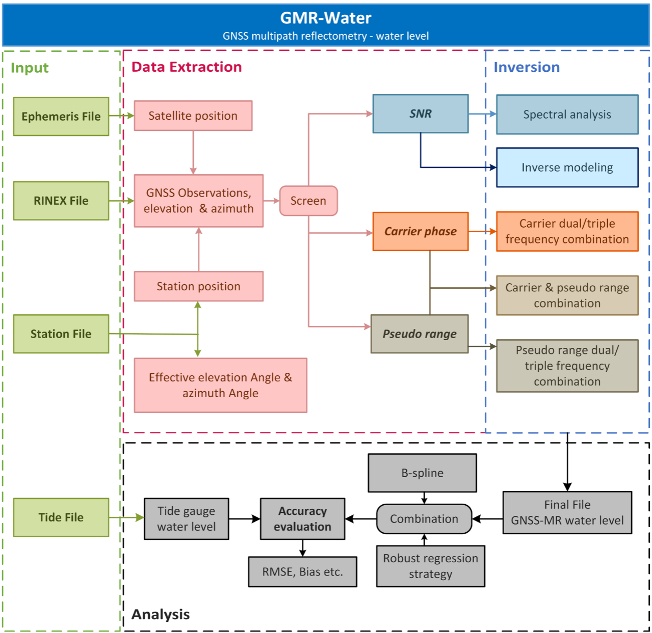
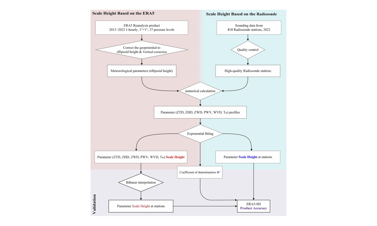
Current project work includes a scale-height research program connecting regional water-vapor climatology with the global ERA5-SH dataset, and GMR-Water, a MATLAB software package for multi-GNSS, multi-frequency, and multi-observation water-level retrieval.
Publication details, paper figures, abstracts, datasets, and software links are available on the Publications and Projects pages.
郝睿贤就读于中国矿业大学(北京)地球科学与测绘工程学院,研究方向聚焦低成本 GNSS 接收机地学应用、高精度 GNSS-IR/GNSS-MR 反演算法,以及面向 GNSS 气象学和大气遥感的对流层关键参量研究。
相关研究围绕低成本观测平台、多源 GNSS 观测、数值再分析资料和独立验证数据展开,服务于地表环境感知、水位监测、海面高反演、对流层延迟改正与大气水汽结构刻画等应用。
目前重点项目包括贯通区域水汽气候特征与全球 ERA5-SH 数据集的对流层参量尺度高度研究,以及 GMR-Water 多 GNSS、多频点、多观测值水位反演 MATLAB 软件;相关代码、数据与文档均已通过 GitHub 或 Zenodo 开放。
论文图件、摘要、数据集和软件链接见 Publications 与 Projects 页面。
blog 博客
selected publications 代表论文
featured projects 重点项目

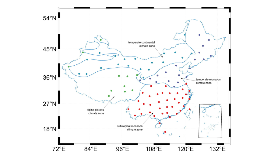
Tropospheric Scale-Height Research 对流层参数尺度高度研究
Regional water-vapor climatology, the global ERA5-SH dataset, and height-correction applications. 区域水汽尺度高度气候特征、全球 ERA5-SH 数据集及高程改正应用。

GMR-Water GMR-Water 水位反演软件
Multi-GNSS, multi-frequency, and multi-observation GNSS-MR water-level retrieval. 面向多系统、多频点与多观测值的 GNSS-MR 水位反演。

RTGS RTGS 实时 GNSS 综合处理平台
Real-Time GNSS Studio for acquisition, monitoring, positioning, reflectometry, and standards-oriented data conversion. 面向数据采集、质量监测、定位解算、反射测量与标准化数据转换的实时 GNSS 综合处理平台。